

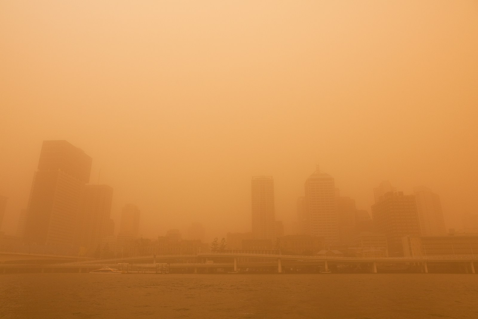

Quick Summary: Dust Storm Warning Issued for Maricopa County Amid Monsoon Surge
- AZFamily forecasts a 40% chance of rain and thunderstorms from Wednesday to Friday, with temperatures potentially dropping into the upper 90s.
- On July 10, Maricopa County and NWS Phoenix warned of increasing monsoon activity, including gusty winds and blowing dust.
- The National Weather Service issued a Dust Storm Warning for Maricopa County on July 12, highlighting hazardous conditions with dust moving north at 40 mph.
- Recreation areas faced varying thunderstorm risks, with some rated as high due to lightning, wind gusts, and heavy rain.
- Despite rain chances, the initial threat is from dust storms impacting visibility and travel before significant rainfall occurs.
Source: Open external resource
Source: Read original article
As Phoenix braces for the monsoon season, residents are caught in a weather drama that’s more about dust than rain. The National Weather Service’s Dust Storm Warning for Maricopa County is a stark reminder that the monsoon’s first act is a hazardous one, with dust storms threatening to reduce visibility to dangerous levels.
The forecast paints a picture of uncertainty. While AZFamily reports a 40% chance of thunderstorms midweek, the reality is that not everyone will see rain. Instead, gusty winds and dust storms are the immediate concerns, with the National Weather Service cautioning about life-threatening travel conditions.
Historically, monsoon season in Phoenix is a mixed bag. The promise of rain is often overshadowed by dust storms, or ‘haboobs,’ which can sweep through the Valley with alarming speed. The current forecast reflects this pattern, with the potential for scattered showers but a greater likelihood of dust and wind.
Looking ahead, the weather narrative is clear: Phoenix residents should prepare for a week dominated by dust, with rain remaining an elusive promise. The focus remains on safety, as dust storms pose significant risks to health and travel, even as the hope for rain lingers in the forecast.
AZFamily’s latest outlook puts the highest rain and thunderstorm chances at 40% Wednesday through Friday, with highs potentially dropping into the upper 90s by Friday and Saturday before nudging back toward 101 by Sunday. The NWS said visibility could fall below a quarter mile and warned of “dangerous life-threatening travel” as winds pushed above 40 mph.
By July 10, Maricopa County and NWS Phoenix were warning of a ramping monsoon pattern and growing chances of gusty winds, patchy blowing dust and eventual rain. The biggest new development is that Phoenix’s monsoon setup has already turned hazardous, with the National Weather Service issuing a Dust Storm Warning Sunday night, July 12, for Maricopa County after a wall of dust was spotted stretching from near Metro Center to Waddell, Palo Verde and Gila Bend and moving north at 40 mph.
For recreation areas on Sunday, July 12, the county rated thunderstorm risk as “Moderate” at Lake Pleasant and “High” at Horseshoe Lake, Bartlett Lake and the Lower Salt River Lakes, with risks explicitly including lightning, wind gusts above 30 mph, heavy rain and hail. NWS Phoenix had already telegraphed the turn several days ago, saying “a more active monsoonal pattern is likely to setup over the Desert Southwest, especially heading into this weekend and next week,” and warning that strong winds in excess of 60 mph, dense blowing dust, small hail and locally heavy rainfall were all possible.
On July 8, official forecasts still emphasized limited rain chances and possible outflows reaching the lower deserts. That warning is the clearest sign yet that the story has shifted from “maybe rain later” to an active monsoon threat with immediate impacts.
In other words, the first headline risk for much of the Valley is not steady rainfall but a fast-moving dust surge capable of shutting down visibility before any meaningful rain arrives. That progression is the real headline from the latest reporting: the monsoon has arrived first as a travel and air-quality threat, with the better organized rain chances still building into the middle of the week.
While AZFamily reports a 40% chance of thunderstorms midweek, the reality is that not everyone will see rain. AZFamily’s latest outlook puts the highest rain and thunderstorm chances at 40% Wednesday through Friday, with highs potentially dropping into the upper 90s by Friday and Saturday before nudging back toward 101 by Sunday.
On July 10, Maricopa County and NWS Phoenix warned of increasing monsoon activity, including gusty winds and blowing dust. By July 10, Maricopa County and NWS Phoenix were warning of a ramping monsoon pattern and growing chances of gusty winds, patchy blowing dust and eventual rain.
The biggest new development is that Phoenix’s monsoon setup has already turned hazardous, with the National Weather Service issuing a Dust Storm Warning Sunday night, July 12, for Maricopa County after a wall of dust was spotted stretching from near Metro Center to Waddell, Palo Verde and Gila Bend and moving north at 40 mph. For recreation areas on Sunday, July 12, the county rated thunderstorm risk as “Moderate” at Lake Pleasant and “High” at Horseshoe Lake, Bartlett Lake and the Lower Salt River Lakes, with risks explicitly including lightning, wind gusts above 30 mph, heavy rain and hail.
On July 8, official forecasts still emphasized limited rain chances and possible outflows reaching the lower deserts. Despite rain chances, the initial threat is from dust storms impacting visibility and travel before significant rainfall occurs.
The National Weather Service’s Dust Storm Warning for Maricopa County is a stark reminder that the monsoon’s first act is a hazardous one, with dust storms threatening to reduce visibility to dangerous levels. In other words, the first headline risk for much of the Valley is not steady rainfall but a fast-moving dust surge capable of shutting down visibility before any meaningful rain arrives.
The scale and speed of this development has caught many observers off guard. Each new update adds another dimension to a story that is still unfolding, and the full picture will only become clear as more verified details emerge from the people and institutions directly involved.
Analysts who have tracked this issue closely say the current moment represents a genuine turning point. The decisions made in the coming weeks are expected to set the direction for months ahead, with ripple effects likely to extend well beyond the immediate actors in the story.
For those directly affected, the practical impact is already visible. People navigating this fast-changing situation are dealing with real consequences while new information continues to reshape what is known and what remains open to interpretation.
Historical parallels offer some context, though experts caution against drawing too close a comparison. Similar situations have played out before, but the specific combination of pressures, personalities, and timing here makes this moment distinct in ways that matter for how it ultimately resolves.
The political and economic dimensions of this story are deeply intertwined. What appears as a single event on the surface is in practice the convergence of multiple pressures that have been building quietly over a longer period than most public reporting has captured.