

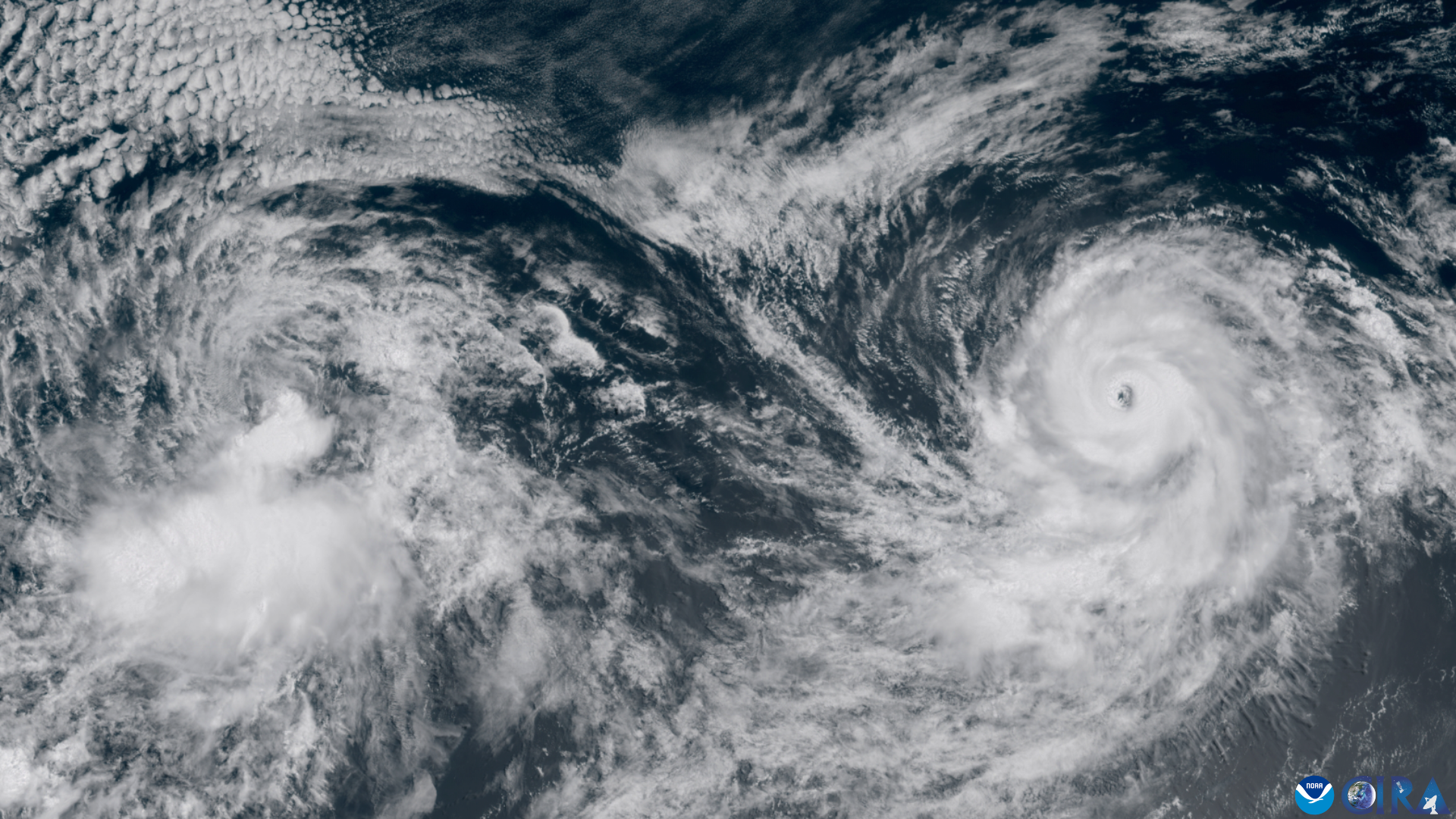

Quick Summary: Mexico Braces for Impact as Hurricane Polo Reaches Category 5
- Hurricane Nolo threatens Hawaii with catastrophic flooding — Big Island residents brace for impact.
- Hurricane Polo rapidly intensified to Category 5 — Mexico’s Pacific coast faces dangerous surf and rain.
- Hawaii’s highest-risk period is Friday into Saturday — officials urge residents to seek shelter.
- Mexico’s coastal communities are fortifying against Polo — sandbagging and evacuations underway.
- National Hurricane Center warns of life-threatening conditions — both storms pose severe risks.
Source: Open external resource
Source: Read original article
The Pacific is in turmoil as two powerful hurricanes, Nolo and Polo, threaten the shores of Hawaii and Mexico. Hawaii’s Big Island is on high alert for potentially catastrophic flooding, while Mexico faces the wrath of a Category 5 storm.
Hurricane Nolo is poised to unleash life-threatening flash floods on Hawaii, with the National Hurricane Center issuing stark warnings. Residents are urged to find safe shelter as the storm approaches, with the most dangerous period expected from Friday into Saturday.
Meanwhile, Hurricane Polo has transformed from a tropical storm into a ferocious Category 5 hurricane, battering Mexico’s Pacific coast. Despite remaining offshore, Polo’s impact is already felt with severe surf and rain, prompting evacuations and emergency measures in vulnerable areas.
The situation underscores the dual threat these storms pose. While Nolo’s danger lies in flooding across Hawaii’s varied terrain, Polo’s offshore power still wreaks havoc along Mexico’s coastline. Local and federal agencies are in a race against time to mitigate the damage.
As both nations prepare for the worst, the focus remains on protecting lives and property from these formidable forces of nature. The coming days will test the resilience of communities as they face the Pacific’s fury.
AP’s Hawaii reporting says the Big Island and Maui were bracing for potentially catastrophic flooding, and the official hurricane-center language has elevated flooding into the headline risk. 20, AP reported Tropical Storm Odalys had formed southwest of Mexico and could strengthen; by early Monday, Sept.
21, Tropical Storm Polo had formed off southwestern Mexico; later that same day AP reported Polo had already become a hurricane and could intensify further; by Tuesday, Sept. What happens next is immediate rather than bureaucratic: Hawaii’s highest-risk period is later Friday into Saturday, according to Brennan’s warning and the hurricane center’s latest discussion, while Mexico remains at risk from lingering surf, rain and coastal impacts as Polo tracks toward the Baja California peninsula after already battering southwestern sections of the coast.
AP reported Tuesday that Polo had strengthened enough for forecasters to describe it in exactly those terms, with rain forecasts of 3 to 6 inches for Guerrero and Michoacán and additional rainfall possible in Oaxaca, Colima and Jalisco. Brennan, as NHC director, has become the key public voice in the Hawaii threat messaging, while local officials in Hawaii are pushing sheltering decisions and Mexican coastal authorities are focused on evacuation, sandbagging and debris removal.
AP reporting distributed Friday said Nolo was expected to churn just south of the islands through the weekend, with officials on the Big Island urging people in flood-prone areas to move to shelters or other safer locations. In Lázaro Cárdenas, Michoacán, AP reported Thursday that residents and officials were clearing away piles of broken wooden planks from destroyed ramadas and shoveling thick mud after high surf hit the port city.
The timeline over the past week shows how quickly the threat escalated. The fact that federal forecasters are simultaneously tracking both Nolo and Polo across the Pacific has added urgency and complexity, especially with NHC also noting continued broader tropical activity in the basin this week.
20, AP reported Tropical Storm Odalys had formed southwest of Mexico and could strengthen; by early Monday, Sept. 21, Tropical Storm Polo had formed off southwestern Mexico; later that same day AP reported Polo had already become a hurricane and could intensify further; by Tuesday, Sept.
What happens next is immediate rather than bureaucratic: Hawaii’s highest-risk period is later Friday into Saturday, according to Brennan’s warning and the hurricane center’s latest discussion, while Mexico remains at risk from lingering surf, rain and coastal impacts as Polo tracks toward the Baja California peninsula after already battering southwestern sections of the coast. Brennan, as NHC director, has become the key public voice in the Hawaii threat messaging, while local officials in Hawaii are pushing sheltering decisions and Mexican coastal authorities are focused on evacuation, sandbagging and debris removal.
Hawaii’s highest-risk period is Friday into Saturday — officials urge residents to seek shelter. While Nolo’s danger lies in flooding across Hawaii’s varied terrain, Polo’s offshore power still wreaks havoc along Mexico’s coastline.
In Lázaro Cárdenas, Michoacán, AP reported Thursday that residents and officials were clearing away piles of broken wooden planks from destroyed ramadas and shoveling thick mud after high surf hit the port city. Hurricane Polo rapidly intensified to Category 5 — Mexico’s Pacific coast faces dangerous surf and rain.
The scale and speed of this development has caught many observers off guard. Each new update adds another dimension to a story that is still unfolding, and the full picture will only become clear as more verified details emerge from the people and institutions directly involved.
Analysts who have tracked this issue closely say the current moment represents a genuine turning point. The decisions made in the coming weeks are expected to set the direction for months ahead, with ripple effects likely to extend well beyond the immediate actors in the story.
For those directly affected, the practical impact is already visible. People navigating this fast-changing situation are dealing with real consequences while new information continues to reshape what is known and what remains open to interpretation.
Historical parallels offer some context, though experts caution against drawing too close a comparison. Similar situations have played out before, but the specific combination of pressures, personalities, and timing here makes this moment distinct in ways that matter for how it ultimately resolves.
The political and economic dimensions of this story are deeply intertwined. What appears as a single event on the surface is in practice the convergence of multiple pressures that have been building quietly over a longer period than most public reporting has captured.